Showing posts with label explorers. Show all posts

Wednesday, June 12, 2013

Mount Everest // Time lapse short film // Expedition photography // Expeditions

To get ready to climb Everest, I did a lot of hill running with a daypack on and a lot of underwater swimming. I would swim a couple of lengths underwater and then a couple above. It gets your body going with limited oxygen.
― Bear Grylls 

 “This forms the nub of a dilemma that every Everest climber eventually comes up against: in order to succeed you must be exceedingly driven, but if you're too driven you're likely to die.”
― Jon Krakauer


Everest -A time lapse short film from Elia Saikaly on Vimeo.


Thursday, December 13, 2012

Because it is there...Find your Inspiration. Share with others. Dig deeper into Adventures Because it is there.


Inspiration is a part of life, an ingredient to the best recipe to enjoy it all. GoPro creates some HD (High Definition) video and collectively the landscape of Adventure on Earth recreates it, share your inspiration and epics with others, big and small. Why journey, why take risks, why sacrifice to get there, why try so hard, why fight the forces of boredom?

Because it is there. Find your own inspiration. Share inspiration with others.

 MongoliaX2012, 2499km of Adventure Inspiration Travel


Dream and find Inspiration for your next Great Journey on Earth.

George Mallory -  "Because it is there."
George Herbert Leigh MalloryBorn: 18 June 1886,  Mobberley, Cheshire, England
Died: 8-9 June 1924 (aged 37), The North Face, Mount Everest, Tibet

Tuesday, October 2, 2012

Explorers, their foundations and social fund raising: A life-size photography exhibition that showcases the soul of Afghanistan (Mountain2Mountain)

Mountain 2 Mountain: protecting women's rights as human rights
[Photo above: Brian Perich]

[Authors notes from Mountain2Mountain foundation] Streets of Afghanistan is a cultural, bigger-than-life art exhibition that highlights the beauty and soul of the land and the people of Afghanistan while challenging existing perceptions of the war-torn country.  A ground-breaking collaboration of Afghan and Western photographers through life sized photography.  
Photography is a means of expression. In a place where expression is often limited, allowing photographers to see their work in their homecountry is not just allowing them to take part in an art exhibit, it's a form of empowerment. Seeing these photographs in the US gives us insight into a world we rarely see; seeing these photographs in Afghanistan is a statement, uniting a group of artists that are committed to political change. 
The Streets of Afghanistan emerged from the vision of Mountain 2 Mountain, a thriving Colorado-based nonprofit that adamantly believes that women's rights are human rights. We believe that in order to provide opportunities and empowerment to women and girls, we must encourage and include the entire community, including men.
One founding ethos was the power of voice and the connection of communities and cultures to foster deeper understanding, compassion, and change.
We believe that change and empowerment must come from the inside.
Websites

Thursday, September 20, 2012

Images of Bicycle Travel: Day Trip MTB @ The Mongolia Crossing Project

We won the Lotto! No, we traveled to outer Mongolia!
Natural hues of an amazing sky at sunset in Olgii, Mongolia
Dry bones. Can you name this animal?
My friend rented a mountain bike and we set out for adventure.
Our third amigo, he is new to MTB adventures
North of Olgii, we rode up in the hills past the sheep heads for beers.
Storms were brewing as they always do in Mongolia.
Looking back to Olgii, Bayan-Olgii Province.
Cycle and Motorcycle touring in Mongolia is epic.
There is a sky out there that will take you by surprise.
Clouds, they tell stories of Genghis Khan and the Mongols
Day trips with backpacks are relaxing, easy, and rewarding too.
Gravity helps us float back into Olgii to stay the Gers.
Speed and gravity, the endless pursuit of motion.
Backpacking for a day out in western Mongolia.
Ride on!  Inspiration is in the journey ahead of you.

Thank all the team at Lynskey for amazing Ti frame fabrication!

Support for this expedition came from LYNSKEY USA, Makers of fine titanium frames.

Dream the big rides, face all the fears, live all the dreams.

---

Brian Perich
Adventure Cyclist, Explorer, Father, University Lecturer
Facebook groups, 1, 2, 3
Skype: prof.brian.perich
Ph. 82.10.8075.5121 (South Korea)

Monday, September 12, 2011

HimalayasX2011, Western China Expedition supporting IDEAS & Education Through Expeditions


HimalayasX2011, Western China Expedition supporting IDEAS & ETE (Notes)

by Brian Perich on Tuesday, September 13, 2011 at 3:28pm

HimalayasX2011, Western China Expedition supporting IDEAS & ETE
Lo-Fi version 1.0 shot with a GoPro Helmet Hero camera Trailer for a self-supported expedition by bicycle across western China, Xinjiang Uyghur Autonomous Region, the Taklamakan Desert, the northern Himalayas, crossing both Sichuan and Yunnan provinces....
  
Comments from the brief video, notes on cycling in western China, photos and foundations 
    • Murray Du Plessis: 
      Yunnan looks like the place to be in China!

    • Nathan Busch:
      Did you up that pass to the west of Chengdu? Looks like there's one pass there that goes up to 17,000 ft... (at least looking on google earth). ah, if only i'd not sworn to myself to go home in december, i think that's where i'd be headed..

    • Brian Perich: 
      ‎Nathan Busch - change plans and ride there! I rode from Chengdu to Xinjin, Luding, Erlung Mountain tunnel (eek, hell...place to die!), Shin-Do-Cheng, but that epic peak of 17000ft is probably inside Tibet, off limits this year, so I routed 857km southwest to Jolong, Mianning, Xicheng, Yan Yuan, Lugu Hu (SIchuan and Yunnan borders) and continued to Lijiang and Shangri-La (night ride was awesome with a tiny headlight!) and Deqin (Baima Snow Mountain) and in sight of Meili Mountain but there's a huge descent into the valley and up into the Tibetan border too...stopped there, this was about 2200km from Chengdu, the first half I spent in Xinjiang with the Taklamakan crossing all the way from Urumqi, Korla, back to Tian Shan MOuntains that crossed earlier along the G314 (Silk Road paved, linked to KKH Karakoram Highway) and at Luntai, you drop south 552km and cross the desert to Min Fung (a great experience, a Nan bread a day! pissing out of my rear and keep pedaling, explosive not continuous so no problem). And on to Yecheng along the southern Silk Road, to Cudi Mountains Himalayas and stopped at military checkpoint and all the way back to Kashgar! Fieww! I didn't ride Tibet and 1000's of Chinese do with many guesthouses along the way (scattered inside ofcourse when terrain gets worse) but in teams, I couldn't believe the 100's riding to Lhasa from Chengdu, Sichuan...that's the way it went.

    • Nathan Busch:
      Wow, sounds amazing... cool. Once in a lifetime thing. I don't think that pass is in Tibet, its near Zhong Shan peak (China Mountain), and not too far from Chengdu. It's not a peak, just a pass (some nearby peaks are like 20,000 feet.) I used to ride up a pass in Colorado, where I'm from, that was 12,000 ft, and there's a race there that finishes at 14,000 feet, but it looks like the Himalayas in that area are more jagged and a bit taller so it would be cool to check it out.. but I have other stuff to consider such as going back to school, etc... anyway, looks like fun.

    • Brian Perich:
      I don't use Google Earth, but I should...I rely on local maps, from my journal, Khan-Zhe-Do Mountain 4298m (14,100 feet), Mopan Shen 2200m, Lugu Hu Lake, 2785m, longest tunnel between Jolong and Mianning was 2.7km, Joling Shen 2930m, Deko Shen (MOuntain) 4032m with Sino-TIbetan yak herders,70km north of Jolong 3750m (notes: walking up the mountains), Sin-Do-Cheng 3000m, Ji Chou Shen 4320m, Baima Snow Mountain 4265m (camped here) and the most important, but overcast when I ended the expedition and didn't reach the basecamp of Meili Mountain, the place to see for sure -

    • Brian Perich: 
      Meili Mountain or Kawagebo http://en.wikipedia.org/wiki/Meili_Snow a great place off the bike for trekking, I've seen friends photos and met trekkers in Deqin on their way out there. I am alone and malnourished and near the end of the road with Tibet, overland and air it took a week to return to Korea to get an idea. I will go back and trek here, cycling through to Tibet of course, would be a winner too, but not with political and cultural tension now, need peace within to visit down the road

      Kawagebo - Wikipedia, the free encyclopedia
      en.wikipedia.org
      Kawagebo (卡瓦格博, Chinese transliteration of the name of Khawakarpo) 

      • Nathan Busch: 
        ahh, yeah, that area, i saw that on Google E, too. Right, Tibet would be a hassle what with getting visas, etc.. plus maybe dangerous. The area I saw was further North and East. I never realized til I had a whole week sitting at work with absolutely no work to do and time to use internet for fun how huge the Himalayas are, as a mountain range. Seriously, must be like 5000 km long or something. And then once u get over that ridge, the high altitude plain just keeps going for hundreds and hundreds of miles...

      • Brian Perich: ‎
        Nathan, I've googled cycling Tibet and know a few who have ridden the entire backbone of the Himalayas like Rick Gunn, also a Coloradoan. It's the epic bicycle challenge and a sacred world to explore on and offroad in Tibetan territories. If only Beijing wasn't so self-destructive in these territorial areas, we would see much more on the inside, it's a conflict zone now and perhaps always will be, also zoned to become a large Chinese holiday destination as the 100s of cyclists I met were all headed for Lhasa from Chengdu and a dozen or less a day ride the backbone from Kashgar-Yecheng-Cudi-Mazar-Sashe-lire and Honloutan-Tomar-Zitour-Ali-Zhongba-Saga-Lhaze-Shigaze-Lhasa- and on to Chengdu. How to do it legally on a bike? I don't know and there are many more military checkpoints than ever before with the disputed borders with Pakistan, Afghanistan, India and Nepal right on the western/southern borders.. Rick Gunn found a way and his http://www.soulcycler.com/may give some photographic insights

        Soulcycler
        www.soulcycler.com
        Welcome to the home of Rick Gunn, photographer, cyclist and adventurer


Foundations: HimalayasX2011 expedition supports ETE Education Through Expeditions, UK where explorers meet students in the classrooms and inspire, educate and encourage learning through Global Adventure Exploration. http://www.etelive.org
Foundations: IDEAS Intestinal Disease Education and Awareness Society, Canada, providing HOPE and community support for those suffering from IBD (inflammatory bowel disease)      http://nogutsknowglory.com and http://weneedideas.com                                                           


                               Xizang Tibetan Autonomous Region of western China
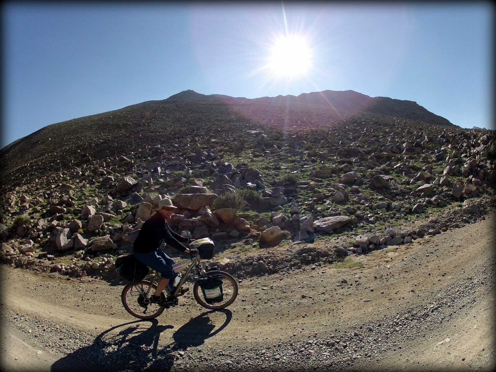
 Reaching the peak, Khan-Zhe-Do Mountain, 4298meter 14100feet


(Camera: GoPro Helmet Hero)